|
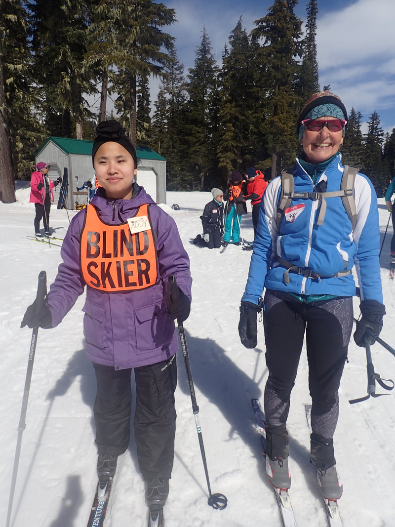
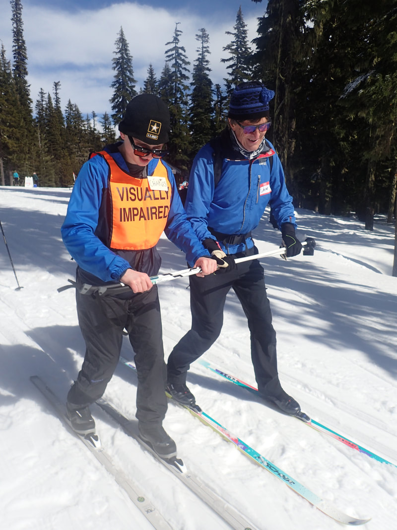
Another year of volunteering with Washington State Blind School to ski with visually impaired teenagers. Fun day with these amazing and inspiring kids. Nothing is impossible! Holden Village on Lake Chelan, Washington A friend of mine has been working there for the 6 months over the fall/winter so I decided to make the trek to visit. And I mean trek! Drive 6 hours, boat ride about 2 hours, 12 mile bus ride on gravel road to the Village at about 3000 feet elevation. This village began as a mining facility/town, in the 1930’s housing up to 600 people during its peak. The Lutheran Church came to ownership in the 70’s and have turned it into a “retreat”. Today, the many buildings house paid and volunteer staff and about 100 paying guests, all year. The school is part of the county school district, they generate their own power, have an extensive library, and host guest speakers on a wide variety of topics. The Village is self-sufficient to the degree possible considering they are a long way from “civilization”. In addition to the school, they have several on site medical staff, a trail groomer, a pastor, a carpenter, and I don’t know what others. Much of the day-to-day work is done by short and long term volunteers which includes kitchen and cooking duties in the large kitchen and dining hall. During my visit, I did a little Nordic skiing, some running, and attended a presentation by a ski mountaineer; I learned that Bonanza Peak, visible from the Village, is a ski mountaineering destination.
1 Comment
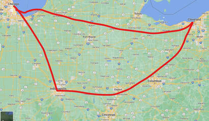 This is a very rough drawing of the route. I’ll be starting in Chicago and following ACA route Chicago/New York to Indianapolis, then making my way to Cincinnati to pick up the Ohio to Erie bike trail to Cleveland. From there, I’ll head west back to Chicago. I’ll mostly be camping with a few hotels and a few WarmShowers along the way. Want to join me for any section? See contact page and let me know! I shared a rented house in Bend for a week near the end of 2021 and once we got over the pass on that incredibly stormy day, the weather was clear but oh so cold. It was really nice to have a large, quiet home to stay in, with a garage! We skied a few days at Virginia Meissner Nordic area with beautifully groomed trails, a nice new warming building, and lots of people! We did a bit of hiking also. Got my new Eddyline Sitka kayak wet for the first time – christening ceremony forthcoming. We paddled up Salmon Creek, which is very high this time of year, making for lots of options. Did a little garbage pick up and came across Wilson’s big brother. This only makes sense if you know the movie Castaway. A group of us picked the perfect day to hike the Tilly Jane trail near Mt Hood. The views, as you can see in the photos, were endless. Upping my running mileage this winter, with a target of 50K Ultra in late summer. In spite of my unfounded concerns about traveling to and in Mexico, I could not resist a supported bicycle trip to the Yucatan Peninsula. Turns out my concerns were indeed unfounded and unnecessary. Arriving in Mexico via Cancun (and on our bikes next morning out of that chaos), I was impressed with the level of COVID awareness and enforcement absolutely everywhere. During my 9 days’ adventure, every single indoor location (and some outdoor as well) required masks, temperature taking and hand cleaning. Not one local or tourist took issue with the rules. The fun began upon arrival at our hotel in Cancun, meeting my fellow travelers all from US and one from Canada. It was evident right away, even with our varying interests, we were all up for the adventure of riding mostly low traffic back roads, pot hole infested dirt roads, and averaging 40 or so miles per day in the heat and humidity. Our organizers and all-around cat-herders: Kurt (from Portland OR), Marie, originally from France but long-time resident guide and Maya expert), Alex our patient van driver extraordinaire as well as rest stop concierge and bike wrangler, and Renee our sort of “unofficial” guide and all around support (Kurt’s wife and just not officially guiding on this tour). Because we were usually in motion from sunrise to sunset, then dining, then dropping into blissful sleep, I didn't do a day-by-day narrative. I just was too tired to write much stuff down. The good kind of tired! I was particularly excited about this trip as I’m very interested in the Maya and had visited several ruins in the past. Our first stop was Uxmal, where Marie demonstrated her thorough knowledge of the ruins and unbelievably, could recite the history of the rulers and pronounce their names. Thus began my daily peppering of questions. No doubt my tour buddies were just wishing to get out of the sun and sit down with a beer. In the coming days, we rode to Chichen Itza, Ek Balam, Coba, Tulum, and the Sian Ka’an Biosphere reserve. Along the way, we swam in a couple of cenotes, did a lazy float (wearing life jackets on our bums; see photos) down a beautiful river. We spent two nights in Valladolid, one of the most historic cities in the Yucatan. We stayed in many historic hotels, ate regional specialties, and rode along the western coast of Cozumel; the sea breeze and even the headwinds were welcome. Everyone was pleasantly surprised by the cars and traffic. On the back roads, cars approaching from either in front or behind (and we were pretty spread out), flipped on their flashers and proceeded with much respect and caution in passing. Absolutely no honking, gunning engines, or throwing stuff from their windows. We did encounter a few that stopped to take photos or give us a thumbs up. On the occasional wide highway with plenty of shoulder, cars and trucks gave us a wide berth. Kurt was a life-saver when midway through our trip, the rules for returning to the US via air changed. He figured it all out, and got us to the right place at the right time to get our COVID tests. It was a wonderful way to start the beginning of winter in the PNW and the end of 2021, by going someplace hot. Click here to find out more about the tour company Bicycle Adventures. Next up self supported bike tour – Chicago-Cincinnati-Cleveland and beyond. Viva Mexico! Viva Bicycle Adventures! One of our "tribe", Peter, created this cool YouTube video. Click here to view! Click here to view another of Peter's fun YouTube videos. 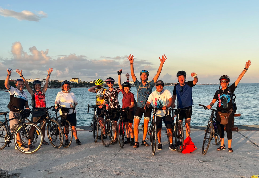 I wanted one more tour this year, so I decided to revisit North Seattle and Olympic Peninsula to see how things have changed in the last 8 or so years, and as progress is made on the Olympic Discovery Trail. Day 1, Seattle to Kingston, 20 miles My train arrived in Seattle sort of late in the day, and assuming I remembered a route to Edmonds WA to get the ferry across Puget Sound, I felt I could make closer to 30 miles. You know what they say about “assumptions”…well I eventually made it to Edmonds to catch the 7 PM ferry to Kingston. Knowing I would not make it much further before dark, I asked around on the ferry for camping options in Kingston, and was fortunate to connect with a man who belonged to a local church. After confirming with the Pastor, I was invited to camp in the churchyard. I set up my camp in the only flat area, the kiddie playground. Day 2, Kingston to Port Townsend, 40 miles After a leisurely breakfast stop at the Cup and Muffin in Kingston, I proceeded onto the busy northbound Highway 104. Good shoulder but the big traffic was a little unsettling. I stopped at a visitor center for my break and then on to Chimacum. While taking another break at the local hangout, I was given guidance to the Larry Scott Memorial trail, which would get me off the highway for the remaining 7 or so miles into Port Townsend. I shared an ocean side campsite at Port Townsend’s Fort Worden State Park with a delightful fellow traveler originally from Romania, named Flavia. Day 3, Port Townsend to Sequim, 43 miles I backtracked some on the Larry Scott trail, then headed to Hwy 104 then to Hwy 101. The Olympic Discovery Trail officially begins in Port Townsend (first section shared with Larry Scott trail), and still much work to be done on the section from PT to Sequim. Signage guides users off and on quiet side roads but some Hwy 101 must be ridden at this point. Shoulder is mostly adequate. Once I got to Blyn, it was a real trail all the way to Sequim State Park about 9 miles on. I was happy to see Flavia also arrive to set up camp at Sequim. Another tourer, Colin, also appeared to share the hiker biker sites. I stayed 2 nights at Sequim State Park before heading towards Fort Flagler State Park. Day 5, Sequim to Fort Flagler, 29 miles The route involves a very dangerous section of Hwy 101 so when I got to Discovery Bay, I waited for a regional bus which got me to a transit center about 6 miles up the road. I then rode the hilly route out to Fort Flagler. Fort Flagler definitely warrants some exploration as it was an army fort guarding the entrance to Admiralty Inlet, and much of the military bunkers and artifacts remain. The biker campsites are the best! I had tent-side views of the beautiful sunset. Day 6, Fort Flagler to Port Ludlow, 20 miles Arrived in Port Ludlow and had several hours before I was expected at my Warm Showers host, so I basked in the sunshine, the last of which I’d see for the remainder of my trip. My Warm Showers hosts, Ben and Anne, gave me a warm welcome into their lovely home. Their love of cooking was apparent in the wonderful dinner they prepared for me. They have had many touring adventures and I enjoyed hearing their stories that evening. Day 7, Port Ludlow to Seattle, 26 miles I realized as I was packing up, that I had left my helmet at the restaurant, which wasn’t open yet. Thankfully, Ben was able to loan me one and later recovered mine. Traffic wasn’t bad on my route through Poulsbo except where I made a wrong turn. The rain came quickly but I was ready for it and stopped in a bus shelter to gear up. It poured rest of the way to Bainbridge ferry, which I was fortunate to board right away. A short ride to the train station and several hours early, gave me the time to dry out before the train ride home. Another tour in the books. Already thinking about next years' tour options, maybe Natchez Trace or Chicago to Cincinnati to Cleveland to someplace...
Ha. No, I didn't! Only in my dreams. I did, however, have the opportunity to cheer the runners on a three day Pacific Crest Trail Association (PCTA) trail work party. Party? Well, that's what they call it... There were 11 of us including Jack, our crew leader. We were tasked with doing rock work on a section of the PCT to improve the tread to make it a bit safer. We worked hard for two and a half days, camped, and ate wonderful food provided by PCTA and prepared by our volunteer chef, Matt. PCTA has been working sections of the trail during the Cascade Crest 100 for more than 10 years. We were provided the bib numbers so we could look up their names and cheer them by name as the passed through the beer gauntlet. Yes, we gently taunted them with beer and some even paused for a few sips before continuing on. We also encountered a lot of thru-hikers on their way to Canada. Many stopped and we changed over to trail angel mode, offering beer and some of Matt's great food. Trail work is a great experience. Consider joining a work party with PCTA or Washington Trails Association (WTA) or one of the other many trail advocacy organizations. You'll be tired at the end of the day, but you'll develop a sense of pride and ownership. And, you're sure to have some great fun! A few photos from other stuff, subsequent to the bike tour - hiking, running, paddling, volunteering..... Closing thoughts on Route 66 Total miles ridden, St. Charles to St. Charles (see Katy Trail post also), just over 700 and 23 days including some zero days. Total miles traveled, about 800. If you use Google maps for cycle directions in unfamiliar areas, use caution. Riding the gravel/rocky roads from Olathe (O-lay-tha) was not what I expected and I would not wish it on anyone. Same with some of the other highway riding, including Highway O previously mentioned. The best moments, the ones that really touched me, were when the people I met showed kindness, in their own way or told me I inspired them. I hope you've enjoyed this travelogue; let me know by posting your comments or questions. Stay tuned for the next adventure, likely in the fall a little closer to home. Chesterfield to St Charles and end, 15.2 After crossing the Missouri River on the Daniel Boone Memorial Bridge, I was “home free”, riding again on the Katy Trail for the remaining miles back to my car and hotel. Pacific to Chesterfield, 24 miles I picked up the Allenton Road, which goes through Six Flags Resort, and is a popular cycling route. Comforting to know that this back road is familiar to both drivers and cyclists. First 5 or so miles was all climbing but I felt good and made it to the summit parking area where I chatted with a road cyclist while I caught my breath. The road wends through Greensfelder County Park, where mountain bikers, hikers, and equestrians share heavily shaded trails. Sullivan to Robertsville State Park/Pacific Well the route I picked to the State Park was really a bad one, via State Highway O. Hilly, no shoulder, fast cars and commercial big rigs. If you use Google maps for any of your touring routing, be cautious. They are very far from perfect. I was quite fortunate to ask for and get a ride from a kind person, Mitch, who drove me 6 miles to the town of Pacific. I was ready to quit riding after this scary day! Phillipsburg to Meremec State Park Jesse from Safe Rides Lebanon picked me up right on time and loaded my bike into his truck, and he dropped me off in Sullivan, MO, with about 6 miles to ride to the campground. I was warned of a “steep climb” to get to the campground. No kidding. I suspect it was a bout a mile of steep, uphill walking/pushing Stanley. All the while I’m thinking about getting back, 2 days later! The campground was beautiful and I vowed to do nothing for the next 2 days but read and relax. It was hot, but I took my chair over to the Fisher Cave and enjoyed the bug free, natural air conditioning. In spite of due diligence, the racoons got into my food pannier (who knew they could open zippers?) and ate all my lunch and snack foods including 2 packages of gel blocks and half a tube of Nuun. Wondering how that set in their little stomachs. I was able to get a lift out of the park and thankfully didn’t have to walk down the steep hills with my loaded bike. Springfield to Phillipsburg, 48.3 Today was a sufferfest of heat and climbs. Oh, and navigating out of towns is always a challenge for me. I got about ½ mile of downhill, then a mile of uphill. Stanley continues to perform well but sometimes I wish he had an auxiliary power source. After reviewing the elevation profiles for the next few days, I’m thinking of how I might get a lift up the route a bit. I arrived at Rustic RV Park and met the hosts, Dee and Bruce. I was able to find a lift to save me almost 100 miles of misery and though expensive, I did it. I don’t want to suffer ALL the time! Bruce and Dee invited me to dinner and I had a wonderful time hearing their stories. Bruce was a cowboy, as in herding and caring for cows in the middle of nowhere, mostly on BLM land, all over the Western US including Washington and Oregon. They are pushing 80 years old but I would not have guessed. They are vibrant, quick-witted, and still ride and care for their horses and a small farm. Miller to Springfield, 37.4 miles Rolling hills to steep climbs. I did some walking to rest. The highlight of this day was meeting a large group of motorcycle tourists at Paris Springs. I regret not getting more photos! Joplin to Miller, MO, 57.9 Leaving Joplin, I picked up the Frisco Greenway toward Webb City. I met Andy, who was out for his daily ride and has dreams of doing some touring. We had a great conversation and I hope I inspired him to keep dreaming and planning. As I climbed a hill outside of Carthage, a man waved me over to stop at this little campground store. He offered to buy me a cold drink…no way I could turn that down! He told me about his tree business and his grandkids reported on their recent trip to Florida. This encounter cancelled out the dog encounter below. Dogs – sometimes they are pretty terrifying when they race out to the road, barking and growling. I instantly stop and try to keep Stanley between me and them. But when there’s more than one, they tend to surround me. Today, one particularly aggressive dog attacked my pannier and was biting it. I dropped my bike and grabbed a water bottle. For all the good it’s gonna do me. It’s usually a hurry up and wait for the dogs to lose interest, which they eventually did. I found a quiet school yard to camp in, which had plenty of power outlets. Prairie State Park to Joplin, 37.3 miles More gravel but at least it’s flat and easier to ride on. The last 10 miles into Joplin and a hotel room was on Highway 171, busy and fast traffic, but a wide shoulder clear of debris. I had a nice break on the way, setting up my chair, drinking ice cold tea and a pre made sandwich made on “wonder bread”. Haven’t eaten that kind of bread since I was a kid. Oh, was it good! Once checked into the hotel, I walked to the nearby grocery store and got salad and some deli chicken. Great to have fresh food! Day 13, Fort Scott to Prairie State Park, 29 miles and more gravel
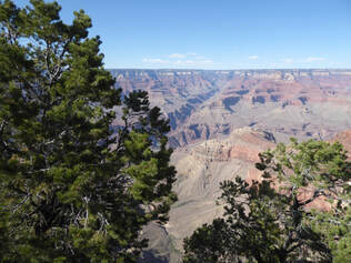
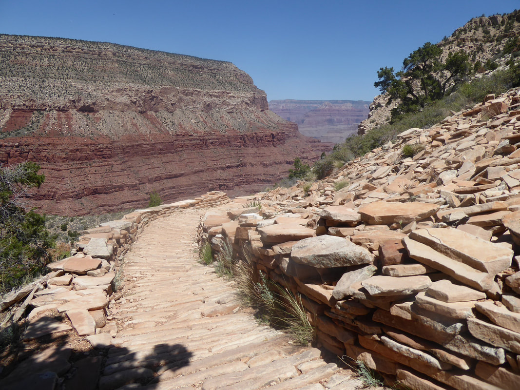
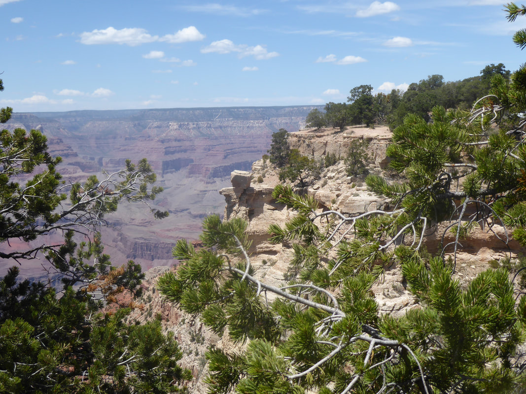
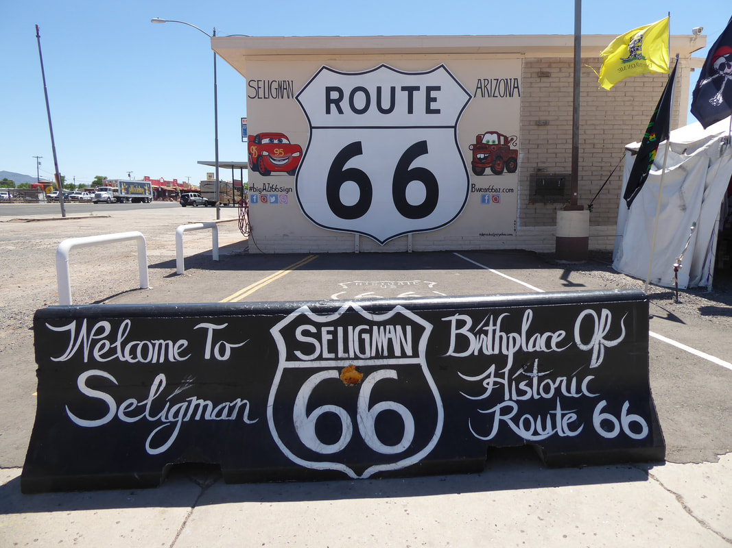
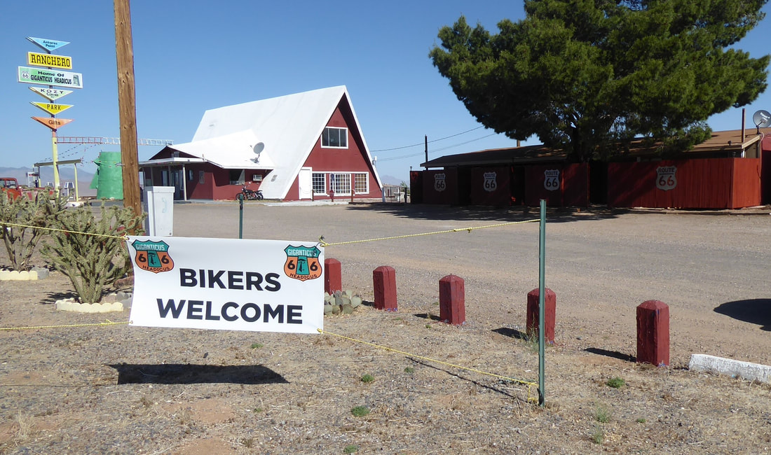
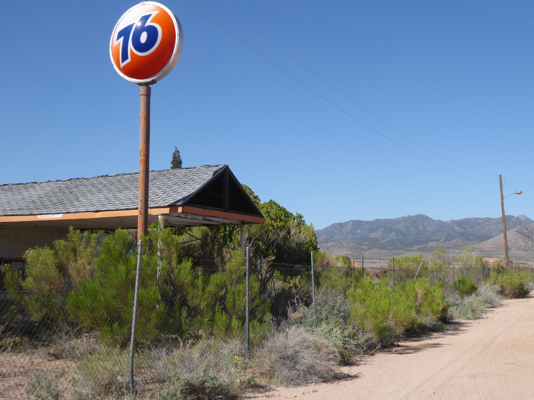
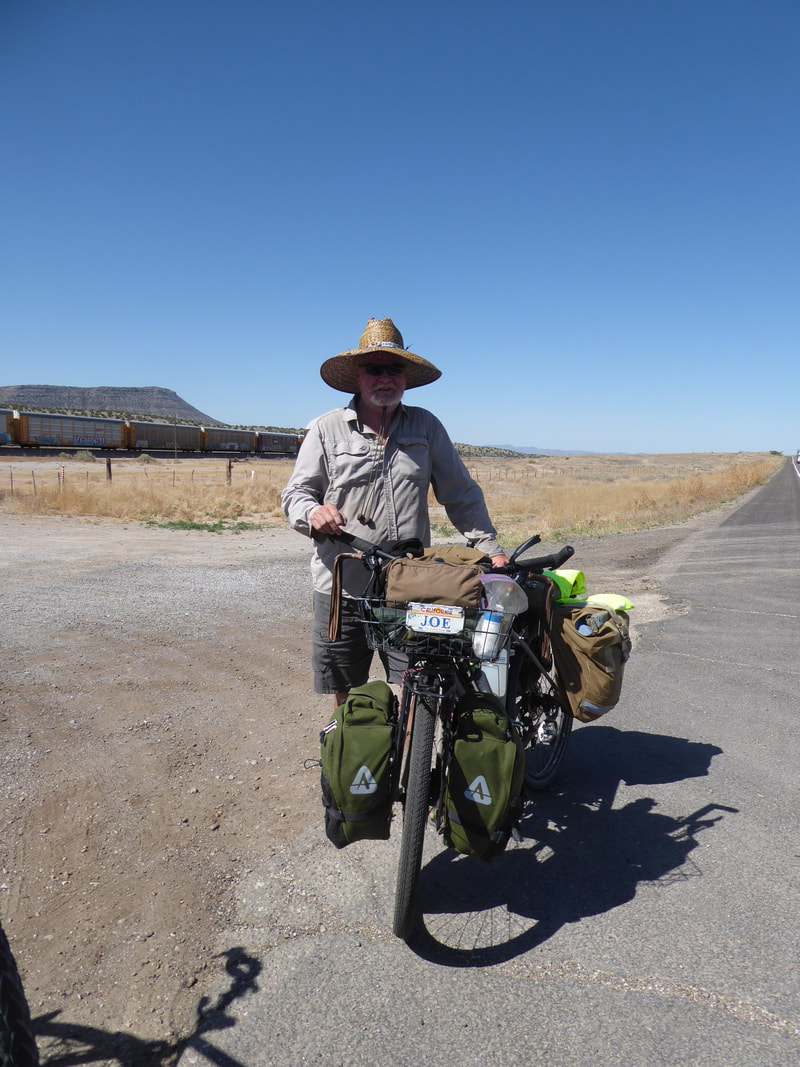
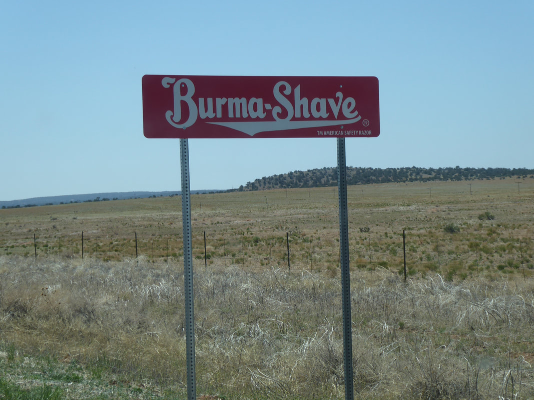
I took a break just 4 miles from the State Park, in Mulberry, Kansas, a former mining town, population about 500. Set up my chair (oh how I love my Helinox Zero!) and discovered the county provides free wi-fi! So, I just relaxed and checked the weather. Turns out the rain was coming, so I packed up and raced onward to the park (please no gravel). Well the last 1.5 mile was gravel but much easier riding than previous days. Made it to a nice campsite, sheltered by the trees and barely got wet. Day 12, Pleasanton to Fort Scott, 27 miles and only 7.5 gravel I have been a little surprised, with all the traffic on the gravel roads, that no one has stopped to ask me what I'm doing out there in farm country. Well today, Randy Ratty stopped and we had a nice chat for awhile. He's proud to say he's retired from the power plant where his high risk job paid well and set him up for a comfortable retirement. Arriving in Fort Scott, I again opted for a hotel, the Courtland, built in around 1900 and restored in the 80's. It's just a lovely, and homey place. I felt welcomed when I walked into my room, decorated with antique furniture, muted colors, and a quilt that my grandmother could have made. Fort Scott was a very important military base during the early days of of the US. Anybody traveling near there should take the opportunity to visit. The Race Across America goes through there and although the cyclists don't really stop, there's plenty of support crew who spend money and time in the town. Day 11, Linn Valley to Pleasanton, 17 miles Short day, 90% gravel. Stanley performed well and continued to amaze me with his agility on these miserable roads. I had a great burger at Cookees in Pleasanton. It's a 50's style diner and chatted with the owner about what goes on in Pleasanton with a population of about 1400. She told me that the following week, the annual Christian motorcycle ride will be descending on this small town, with about 1000 riders. There's a motorcycle museum and another regional museum; both closed today. Hunting is popular, as is living here and working in Kansas City. I made my way to the vast city park with a lake and several stone shelters. Spread out my ground cloth, and just relaxed rest of day. There's no water available, but a kind neighbor brought me into his home and let me fill everything from his refrigerator tap. Day 10, Olathe to Linn Valley 46 rough miles What's with all this gravel??? I had no idea I'd be riding on gravel/rock roads. It was slow going and much walking on these rough roads. Oh, and some hills too. Some of the rock was too difficult to ride on so I walked quite a bit. This day was about 85 percent gravel and little did I know that there was oh so much more to come. I made it to Linn Valley Park, a private camp/park/lake. I was very grateful to be able to camp there, close to bathrooms and showers. The nice security lady, Janet was kind enough to give me two cold bottles of water. Pitched my tent and was asleep before dark. Onward to Leeton then Pleasant Hill On the way to Leeton to camp in the city park, we stopped in Windsor and found the only place open - the Side Track Cafe. We had the best ever burgers before traveling the remaining 10 miles. We're now on the Rock Island Spur, a route that continues northwest to Kansas City. Continuing on to Pleasant Hill to camp the following night, Jim will then proceed to Lee's Summit (southeast of Kansas City), where he'll catch Amtrak back to his car in St Louis and head home. I'll continue to Olathe for two nights in a hotel before heading south/southwest to Joplin. Day 5, Pilot Grove to Sedalia, 28 miles We got a few bonus miles today, looking for the fairgrounds in Sedalia, where we planned to camp. Turning unexpectedly colder. I chatted with Jeff from Rolla, on the trail, who's starting a new gravel touring business. He offered me his front yard for camping, when I get to Rolla on my return leg to St Charles. Sedalia was given the choice to have the state college or the fairgrounds. They chose the fairgrounds. Sedalia has been hosting the Missouri State Fair since 1901 on almost 400 acres of grounds of 47 buildings. Day 4, McBaine to Pilot Grove, 38 miles Weather has been getting cooler during the day, necessitating long sleeves and sometimes leg coverings. We had read about the dreaded Salt Creek Detour...a bridge on the trail that had washed away in 2016 with no repairs planned. I had anticipated this, and found a road route that was actually quite nice; a change from the sandy surface and cave-like trees we'd mostly been riding through. After a 5 or so mile detour, we returned to the trail and had the opportunity to inspect the damages to the bridge. At some point, I'll upload photos. Some riders will trudge through the yucky mud and maybe 6 inches of water, to avoid riding on the road. After a heavy rain, even that option wouldn't be possible though. We picked up some bonus miles in Booneville as I searched for someplace to buy cheap reading glasses as I had left mine at the hostel. No glasses, but we did discover an A&W Root Beer stand with the oh so yummy root beer freezes. Made a great lunch! Pilot Grove is a delightful little town with a wonderful city park that welcomes bike travelers to camp for free. Covered shelters, bathrooms, and water available. The local Dollar General was a 3 minute walk in one direction and I got my glasses. A few minutes the other direction was a Casey's market/gas station, in case there's something you need that Dollar General didn't have. We met a nice man, Tim, riding a recombant trike. He's from Indiana and was also riding the Katy, but both directions. His great sense of humor in sharing his stories, including that he's had six (yes, six) strokes and a heart attack made for a pleasant evening of conversation. He has some mobility and vision limitations, but dang, he's out there riding self supported. A great inspiration! Day 3, Tebbetts to McBaine, 46 miles We decided to make this day a few miles longer, so that the following day would be less than 40 miles as I had originally planned. I've enjoyed riding with Jim, my ride buddy, as we came up with ideas to maximize our energies and time. Anyway, there was no place to camp in McBaine. So, we found a place near the sewer plant to stealth camp (odor-free!). Day 2, Marthasville to Tebbetts, 54 miles Even though the trail appears flat, there's a grade of no more than 2 percent. On a road, it would not even be noticeable, but with a total bike weight close to 70 pounds and soft surface, it's VERY noticeable. A storm was due this day, and although the worst went north of us, we still got free showers before getting to Tebbetts. We stopped in the tiny town of Mokane, and ducked into the local bar to wait for the rain to stop. We had a beverage and a delightful conversation with Jennifer the young bartender, with lots of ideas to attract the cyclists along this popular route. Arriving at the hostel in Tebbetts was a welcome sight after this long soggy day. We had called ahead and were advised where the key was hanging and that we put our $6 in an envelope and drop it in the US mail box over at the post office. When full, the hostel accommodates about 40 travelers but there were just 3 others joining us this night. The kitchen was adequate and showers were hot. We spent some time washing off the sticky grit from our bikes before storing them in the adjacent storage area. Day 1, St. Charles to Marthasville, 39 miles Marthasville is a small town with a population of less than 2000. We're camping at the local ballfields (game night!) and I think everyone in town must be here. The food vendor is open for business and provided us with a cold beer while setting up our tents. We had both electricity and showers for a camp fee of $6. We're sharing this nice space (covered picnic tables and farm equipment) with four other travelers, going the opposite direction. Apparently Daniel Boone called this town home and he was originally buried here. At some point his remains were relocated to Kentucky. Missouri has never gotten over that. I was fortunate to connect with a fellow bike tourer via Warmshowers.org and we'll be riding together for about five days. Our first day is about 40 miles to the town of Marthasville to camp in a city park. The weather people warning of severe storms on Day 2, Thursday, but with an early start to ride the 50 miles to Tebbetts, we hope to reserve bunks at the Turner Katy Shelter and beat the worst of the storm. The last of Route 66 and arrival in St. Charles Missouri Continuing on Route 66, I visited the vintage cookie cutter museum, went to a circus, and saw a large junk monster. In Uranus, Oklahoma, I saw the worlds largest belt buckle and an alien. I’m in historic St Charles, Missouri where I’ll begin my bike tour tomorrow. Not only was St. Charles the first state capitol of Missouri, it was the starting point for the Lewis & Clark expedition. There’s an interesting museum here telling the story of their preparations and the voyage itself. I hope to post a few updates over the next few weeks, while on my bike. Closing in on Missouri Arizona, New Mexico, Texas, Oklahoma tonight. I am lounging in a beautiful library in Tulsa, uploading photos and elevating my foot, which doesn't seem to enjoy sitting and driving any more than I do! Although, I am enjoying a great Stephen King audio book. He always keeps me alert and engaged. Seems like as soon as I crossed the New Mexico/Texas border, the topography changed instantly, from rocky hills to flat and rolling grassland. Green too! More traffic also, and dominated not only by gigantic motor homes, but shared in number with 40 foot plus trucks loaded with secret goods going to who-knows-where. I passed through the second largest wind farm in the United States, near Amarillo. As far as I could see in all directions, the windmills were silhouetted against a darkening sky threatening some serious rain. Camped out at a busy truck stop last night. I'm glad I made the blackout shades for car windows. I woke to dense fog and just hung out, reading, hoping it would lift any minute, which it did not. Texas and Oklahoma have some very impressive rest stops along the highway, as you can see in the photos below. 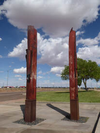 Winslow, Arizona...These are two beams from the World Trade Center, 9/11 remains. They have been installed here in memory of all those who lost their lives that day. Petrified Forest and Painted Desert The plan was to get a back country permit and camp a few miles in and see a bazillion stars. The weather was not cooperating. Prediction was for cloudy skies and winds to 25 mph. So I did some short day hikes. You can get directions for "back country" hikes that takes one off the beaten path, literally. The rangers provide color photographs and notes for navigation to interesting points. GPS coordinates also. I was remiss in logging the waypoints, ended up wandering a bit, and decided not to get lost on a day hike. The scenery was every bit as stunning at Grand Canyon, though in a different way.
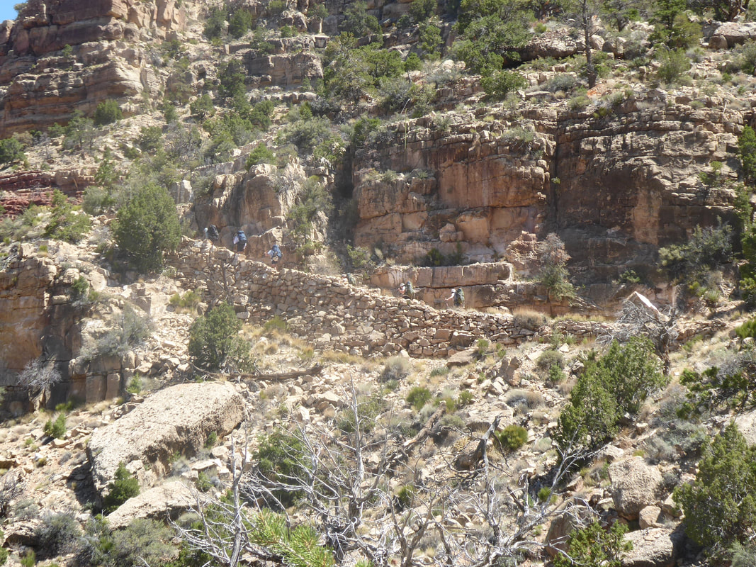
 THE GRAND CANYON IS NOT A GIANT WISHING WELL! Don’t throw coins over the side and hope your dreams will come true. What you’re doing is poisoning the wildlife! Condors and other birds along with chipmunks and other local creatures see shiny things and pick them up and ingest them. Many die a slow and painful death. There’s a group of about 40 volunteers that come annually and rappel over the sides, down as much as 300 feet, to pick up litter that has blown over, as the prevailing winds blow into the South Canyon – plastics of all kinds, food wrappers, and hats. One year, they picked up 400 hats; some still had price tags. There are more volunteers, who dedicate the entire season to monitoring trails, assisting hikers, and facilitating emergencies, should that be necessary. I chatted one volunteer who has been coming to Grand Canyon to sleep in a tent for five months every year, for 8 years. She said the camaraderie and the feeling of helping making a difference brings her back every year. She also said that since this program was initiated, incidents have been reduced by 50%. They do some trail work, but the AmeriCorps Youth Program does the serious trail work with the assistance of pack animals and helicopters as needed. They have done some fantastic work on the Hermits Rest trail… On the Road! The gas tank filled, Stanley dressed for the ride, and we're on our way! The scenery and mountains have been nothing short of stunning, especially for someone who's used to lots of trees and green stuff. Sure is HOT down here! 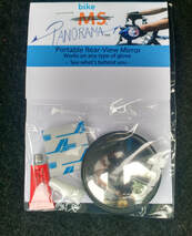 The countdown has begun for the next adventure. I'll leave in mid-May, stopping and car camping in Death Valley , then on to Grand Canyon, Painted Desert and on to St Louis to begin the ride on the Katy Trail, a 300 or so mile Missouri State Park. I'll continue west somewhat, then returning via a modified ACA Route 66, for about 850 miles of adventure cycling! Periodic updates to be made, hopefully. While you're here, check this cool Panorama Mirror, my ride buddy and friend, Robin, has designed and sells. Just click on her name for contact info. If you don't like helmet mirrors or bar end mirrors, this might be just what you're looking for! Now that I'm pretty much healed, except for some lingering PTSD, I'm back to hiking and trail running (with a bit of Nordic skiing), armed with a Garmin InReach Mini just in case. Soon as weather begins to cooperate, I'll be back on Alvin and/or Stanley to train up for the next bike tour. A few photos from local winter trails.... 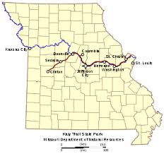 ; In looking forward to touring in 2021 I've decided, instead of taking the train to St. Louis for last years' deferred tour, I'll drive! I plan to visit some national parks, do some hiking and some trail running along the way. For a person who doesn't enjoy long drives, I'll load up on audio books and limit the number of driving hours per day, making for a longer crossing.
I bought an atlas and with several tour books on National Parks; I'm looking forward to visiting Death Valley, Grand Canyon, and others, car camping my way to St. Louis. When I arrive in St. Louis, a gracious WarmShowers host will allow me to park my car at their house for the 700 some miles of my bicycle tour. All the planning for the bicycle tour was already done and with a few tweaks, I'll be ready to hit the Katy Trail and beyond. Stay tuned... I took a few days' road trip to explore the eastern Gorge, and test out my hiking ability and stamina. The scenery is stunningly different from western Gorge and for me all the more amazing. Here's a link to Wikipedia about the formation of the Columbia Gorge. The photos here speak for themselves. 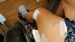 I wasn't sure I'd even write about this, so I'll make it short. In mid-August, I fell from my mountain bike and broke my femur, a couple inches south of my hip. It was a very tough and painful ordeal getting rescued and transported to hospital. Even recovery seemed to be slow and frustrating.
Well, it's about 13 weeks in the past now, and I'm about 80% "there". I've resumed some hiking and even thinking about 2021 touring. |
Categories
All
Archives
May 2024
|

 RSS Feed